
Description
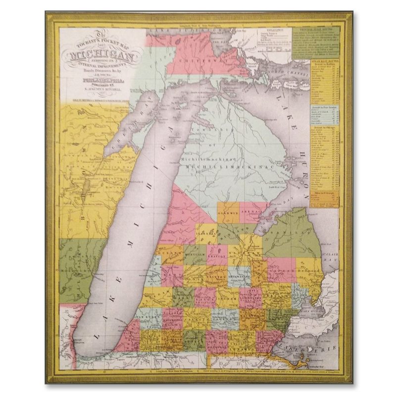
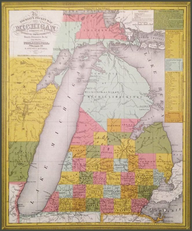
Reproduction of Mitchell’s Tourist’s Pocket Map of Michigan (1837).
This copy of a historic map shows the newly established State of Michigan, which emerged from Michigan Territory in 1837, the same year the map was published. Federal land surveys had not yet been completed north of Gladwin and Arenac Counties, leaving the expansive Michillimackinac township undivided and outside of the public land survey system. Charlevoix County would not be completely surveyed until 1841 and would not begin to appear on widely available commercial maps until several years later.
Size: Approximately 16″ x 18″
Price includes high-quality mailing tube to protect the map during shipping and storage.


Reviews
There are no reviews yet.